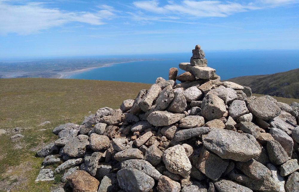
We stood on the saddle between Northern Ireland's two highest peaks in blazing sunshine. Looking back down the valley, we could see the seaside town of Newcastle, where our car was parked. The edge of the Mourne Mountains rose in sharp contrast with the perfectly flat patchwork of fields that filled our view all the way to the horizon. Looking towards the summit of Slieve Donard was a different story entirely. A dense grey fog completely enveloped the peak and obscured the path ahead.
To get to the top of Slieve Donard, all we had to do was follow the Mourne Wall. We decided, even in low visibility, it would be hard to lose this fairly sizeable landmark so we continued on our way.
The fog swirled around us as we made our way up the well-eroded mountainside. Shadowy figures moved in the distance and more than a few times we thought we saw the summit ahead, only to be disappointed. Eventually though, the Mourne Wall turned a corner and we knew we'd reached the top.
What Is The Mourne Wall?
The Mourne Wall is a dry stone wall that stretches for almost 20 miles across the Mourne Mountains. It was built to keep livestock away from Silent Valley Reservoir, Belfast's main water supply. However, as it links the peaks of many of the highest mountains in the Mournes, it now also doubles as a convenient route marker for hikers.
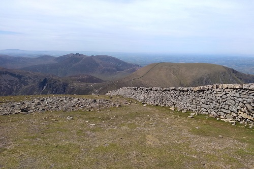
The Mourne Wall
The Summit Of Slieve Donard
The corner was marked with a square tower, originally built to shelter the men building the wall. These days, nobody takes shelter in the towers. They are dark and dank and often accompanied by an overpowering smell of urine. Climbing over a stile, we found all the other hikers. They were taking refuge from the wind on the leeward side of the wall.
While most of the summits in the Mournes can be fairly quiet, Slieve Donard is always busy. There were people relaxing with flasks and sandwiches while others made video calls, keen to share the non-existent view with their families at home. Being there on a race day, we also saw trail runners frantically searching for the elusive electronic checkpoint they had to tag. We ate our lunch, added a stone to the summit cairn, and began our descent.
Slieve Donard: Take Two
We waited for a clear day before we attempted to climb Slieve Donard again. As the coronavirus lockdown had just begun to lift, we decided to walk up the quieter side of the mountain. Even in the car park, we were impressed with the care everyone was taking to maintain social distancing. Every second car parking space had been left empty. When we returned after our hike however, the scene could not have been more different.
Starting by the Bloody Bridge, the site of a massacre in the 1600s, we walked alongside a river. The sun beat down and we were surrounded by the golden flowers of gorse in full bloom.
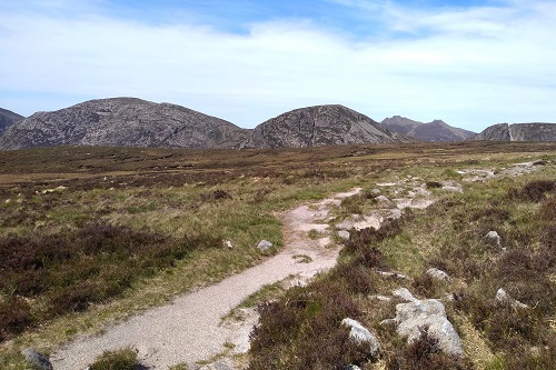
Hiking On The Brandy Pad
We skirted around the edge of Slieve Donard, following the Brandy Pad, an old smuggling route that lead us up to the Mourne Wall. Young tadpoles wriggled around in shallow puddles on the path and we hopped from rock to heather and back again, taking great care not to trample on them.
We climbed Slieve Commedagh first, making a brief dash to the cairn at the summit before finding a hollow to shelter in. Despite the weather forecast promising 'light winds', we were buffeted so relentlessly that we were concerned our sunglasses would blow off.
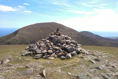
Cairn On Slieve Commedagh
A couple of other hikers, the only other people we saw on that mountain, clearly had the same idea. We sat in the hollow with them joking about the accuracy of the weather forecast as we ate our lunch. However, we were more than a little jealous when they each produced a can of beer. Why have we never thought of this?
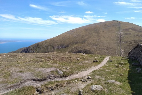
The Path To Slieve Donard
Finding An Easier Route To The Summit
We backtracked down to the saddle and continued up the other side, heading once again for the summit of Slieve Donard. Following the other side of the Mourne Wall, we were really surprised to find a stone staircase to the top. We hadn't even noticed it our first time round. It did make the steep climb considerably more straightforward and it didn't take long to reach the summit cairn.
The views were worth the effort. It was so clear, we could even see the shadowy outline of the Isle of Man across the sea.
Hiking back down to Bloody Bridge, we came across an unexpected obstacle blocking our path. A group of ponies were trekking along the narrow track towards us. We waited patiently, watching the tiny chestnut and white foal as it tottered along behind the adults, stopping to snuffle around in the rocks when they did. Finally, the ponies passed us, splashing across the river as they made their way uphill.
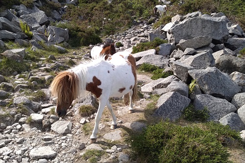
Ponies On The Path
Party At Bloody Bridge
Before long, we began to hear thumping bass, which was not something we expected on a quiet mountain path. Rounding a corner, we caught a glimpse downstream where crowds of people were partying by the river.
Lobster-red teenagers sunbathed, barbecued and splashed around in the water. Beer cans littered the ground, along with nitrous oxide canisters. The lockdown rules had only just been relaxed and already any notions of social distancing had been forgotten.
Finding a quiet spot away from the crowds and the music, we decided to take a break ourselves. We sipped tea and soaked our tired, blistered feet before making our way back to the car park.

The Ponies
It was chaos there too. Every space was full with cars parked along the roadside as well. Groups of people were standing around, blocking the road and making it awkward for cars to pass. We even watched a guy throw a load of empty cans over a hedge when the nearest bin was just a few metres away.
Despite the madness, we were glad to see people out enjoying the countryside. And after 10 weeks or so in lockdown, it was a relief to finally be allowed out ourselves.
How High Is Slieve Donard Anyway?
Not very! Despite being the highest mountain in Northern Ireland, Slieve Donard is only 850 metres high. Most people start their walk at sea level, hiking from the Donard car park in Newcastle. It's around a 10km roundtrip. Hiking at a relaxed pace, with breaks en route and lunch at the top, it took us around 6 hours in total.
The distance from Bloody Bridge car park is similar. It's a slightly less scenic path but it is usually quieter and you can paddle in the river.
Slieve Donard Travel Tips
While many people do complete this hike in trainers, we strongly recommend wearing hiking boots if you have them.
The weather in the Mournes is notoriously unpredictable. Even if the forecast looks good, be prepared for unexpected fog, wind or rain.
There are toilets at both Donard car park and Bloody Bridge car park but none en route.
Bring your own picnic supplies and plenty of water with you. However, once you've finished hiking, Newcastle town is the perfect place to get an ice cream or some well deserved fish and chips.
